Especially in the desert.
The Adventure
For the past couple of months, Selena has been hounding me to do some sort of self powered overnight trip. We had been scheming a backpacking trip to Jordan Hot Springs in the Gila, but with her bad ankle and my old knees, I had been putting it off. We considered a round trip run into the springs but figured at 16 miles total with many river crossings, it would end up not being fun at all. I realized I hadn’t been on an overnight bikepacking trip in well over two years.
Yes.
2……years.
No bueno.
The weather on the border was finally cooling off a little and a full-ish moon was still lingering. Clear skies and a lack of wind made me think that maybe I could pull off something local. I had yet to give any of the Monumental Loop a go other than short sections ridden in few hours. I emailed route creator Matt Mason, then noticed that Ray Molina, inventor of the fat bike, was hosting a party at Hunt’s Hole, so I decided to give it a go.
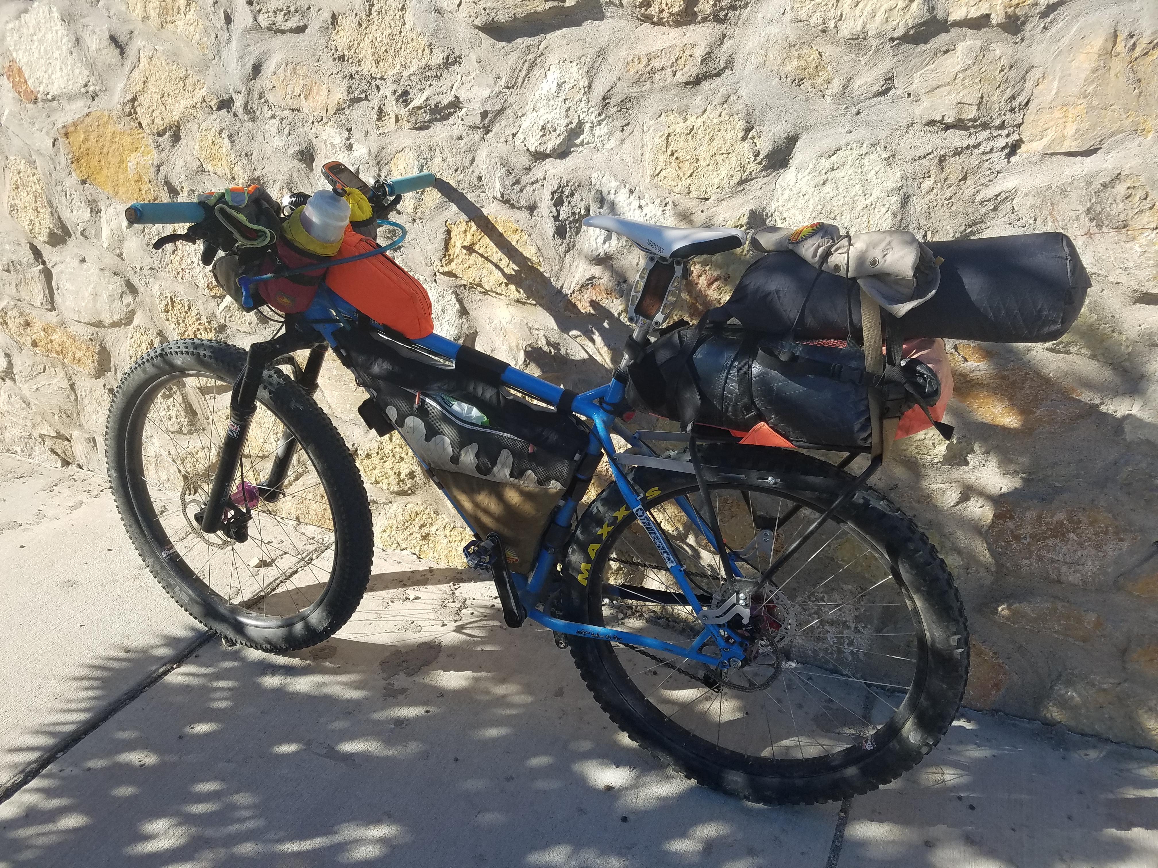
Friday I had jury duty and I was sent home early. Yay! So I quickly made a frame bag for the “girlfriend” bike, a Giant Anthem 29er that I scored super cheap and have upgraded judiciously, and gathered together all of my gear. Combing through the crap, I selected a set up that would keep Selena light on the bike knowing there would be a ton of sandy roads that we would be navigating.
The Gear
If you’re not a gear weanie, you might want to skip this.
Selena’s set up:
My set up:
- Surly Ice Cream Truck XXL (total weight with water….70 lbs)
- 29+ wheels with Ranger TCS Light FR 29″ x 3.0 front, Minion-DHF K DH tire, 29 x 3.0″ 3C/EXO/TR rear
- Old Man Mountain rear rack
- Nuclear Sunrise Stitchworks frame bag
- 100 oz camelback bladder with quick disconnect hose
- Pur/Katadyn water filter
- White Lightning chain lube
- 3 CO2 cartridges and inflator
- 29″ tube wrapped in Tyvek
- Blackburn Mammoth pump
- 2 small bottles of sealant
- Dity bag
- Park tool
- plug kit
- stitch kit
- patch kit
- Leatherman micro
- Pedro’s tire lever
- chain quick links
- 2 cans of tuna
- small container of 50 block sunscreen
- Ziploc bag of drink mix
- Baby wipes (never used)
- Stickers (guerrilla marketing)
- Cell phone
- Exposure Diablo 1st generation with helmet mount
- Nuclear Sunrise Stitchworks Fat Man Seat bag (mounted to rack)
- Mountain Hardware 2 person tent (main tent, poles, 4 stakes, and Tyvek ground cloth….no fly)
- 2 Mountain House dinners
- 2 Mountain House breakfast skillet
- 12 oz bottle of alcohol fuel
- Cookset
- 2 titanium sauce pans with lid
- 2 stainless cups
- Spice
- 2-MRE toilet paper packs
- mayo pack
- relish pack
- Bic lighter
- DIY beer can alcohol stove
- Boonie hat
- Nuclear Sunrise Stitchworks Titan tank
- car keys
- 2-AA batteries
- Business cards
- $25 cash
- credit card
- ID
- toothbrush
- toothpaste
- Energy bars
- spoon
- 2-Nuclear Sunrise Stitchworks Silo feed bags
- Insulated water bottle in one
- Ziploc bag full of almonds and raisins, 4 packs of Honey Stinger chews in the other
- Nuclear Sunrise Stitchworks Handlebar Pouch
- spare bike shorts
- long sleeve tech tee
- swim trunks
- spare sunglasses with soft case
- Stuff sack mounted on top of seat bag
- Garmin eTrex 20 on handlebars
- Amazon light on handlebars with battery under the down tube
The Route
We took our time packing Friday evening and Saturday morning with the intention of riding to Ray’s place/Hunt’s Hole that afternoon. I loaded the gps file for the Monumental Loop onto my Garmin….with the intention of riding from a friend’s house in the Upper Valley area of El Paso to the Santa Theresa Airport/Union Pacific Maintenance area to connect with the Monumental Loop heading out to Cone and Crater Country. Before Kilbourne Hole, we would detour south to Ray’s place, party a bit, then ride back to the route and camp somewhere. Sunday we planned to ride the rest of the southwest portion of the Monumental Loop and finish in Mesilla, NM….then either ride back to the Upper Valley or have a friend fetch us.
Day 1
At 4:30 pm, we started a little later than we probably should have, and didn’t get to Ray’s until about an hour after sunset. Selena had never ridden in the dark before and the moon wasn’t out yet, so luckily we were on soft roads that made cruising fun with our lights working great on the low setting. Of course, there had to be a major issue and it was all me. I loaded the gps track using Topofusion, but failed to check to see if the entire route was actually on my gps. This is something I’ve done before and I should have known better….but it’s been awhile…..2 years. Tracks need to be no greater than 10,000 points to fit on the gps. How it is possible to be under 10,000 points for the Tour Divide route blows my mind. Instead of freaking out, I quickly uploaded RideWithGPS onto my phone and downloaded the course using a 1-week subscription at $3.99.
Cruising the route, we stopped at a solar powered well early in the ride and tried unsuccessfully to get it to work. Oh well. We both had plenty of water to at least make it to Ray’s. An hour or so later we saw one large group of ATVers, side-by-sides, and two jeeps…one being towed. After turning south off route, we passed another tank but didn’t stop. After getting on the road that would take us to Ray’s, we saw headlights behind us and they guy pulled up next to us asking if we were going to Ray’s. The only “normal” vehicle we see on the road and of course it’s some dude headed to Ray’s. About 20 minutes later we hear voices and see bike lights and knew we’d reach at least one of our destinations. This was all before the moon came up and it was dark AF. Ray and his buddy escorted us to the compound for the party where Ray skittered all over the place trying to be an excellent host. It was getting pretty cold and neither of us packed anything to cover our legs and I only packed a long sleeve tech tee. Selena had her long sleeve tee and a rain jacket which she quickly donned. I forgot how cold the desert can get on a clear night. After eating some pork tacos and our Mountain House meals, we loaded up with water and headed out to get back on the Monumental Loop and find a place to camp before Ray and any of his friends decided to break out any firearms or incendiary devices.
We rode about 5 more miles on some nice roads before pulling off to camp. We set up the tent in a couple of minutes and leaned bikes against creosote bushes to prevent rats from chewing on sweat soaked items and Camelbak nipples. It was probably in the 40’s so sleeping in our sleeping bags (I used the 40 deg but carried the 30 deg) was fairly comfortable. The moon blazed like a spotlight into the tent the entire night.
Day 2
Soon after taking off, we passed a muddy cattle tank and I foolishly decided to pump filter some water. It instantly clogged my filter. I got worried. We continued on route and noticed that the roads were a little sandier. There had been plenty of rain the previous week, so there were spots that were still moist, but with some of these roads getting a little bit of ATV traffic, there were some soft spots. Nothing bad enough to air down, but we definitely had to pick our line.
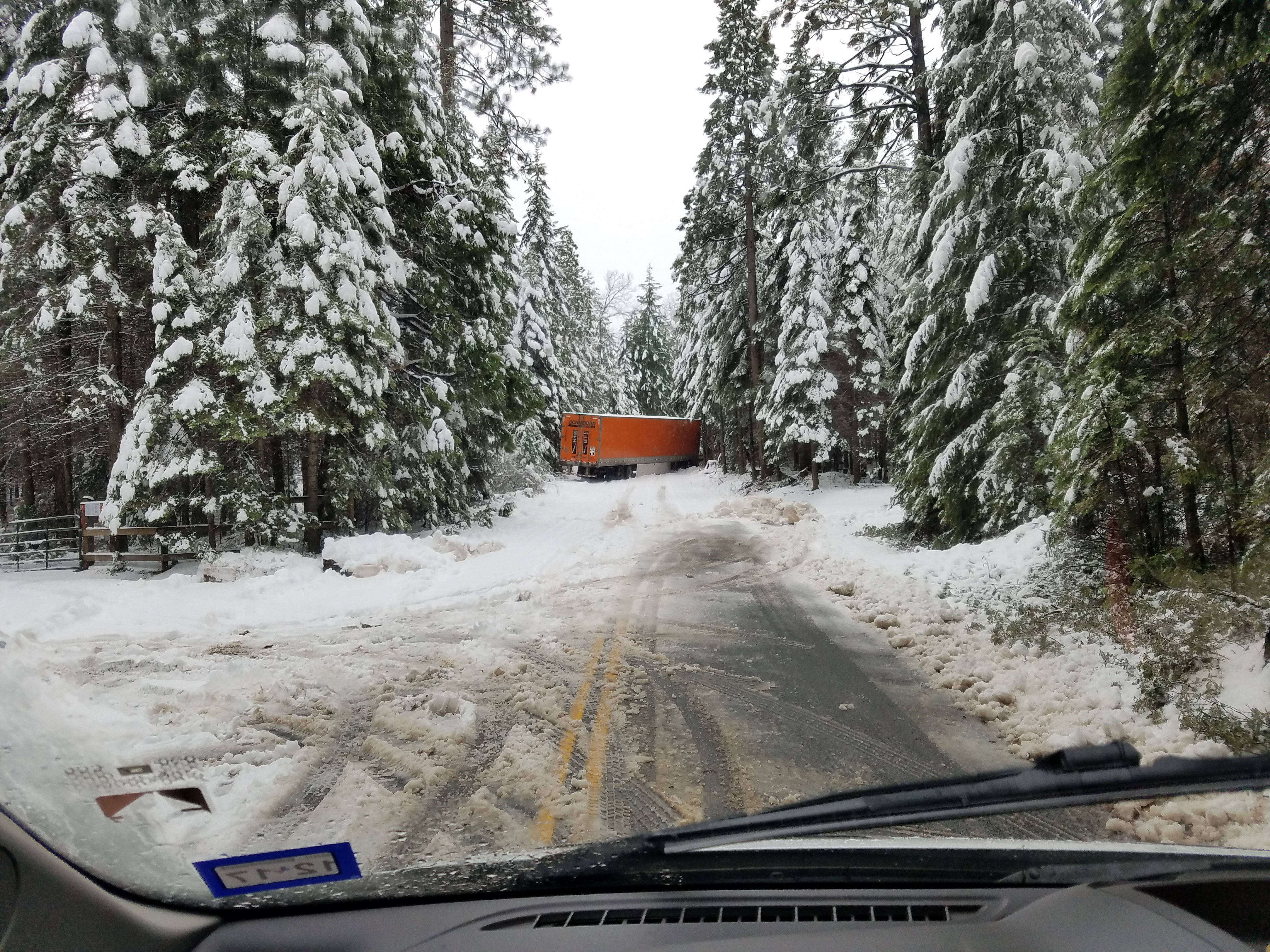
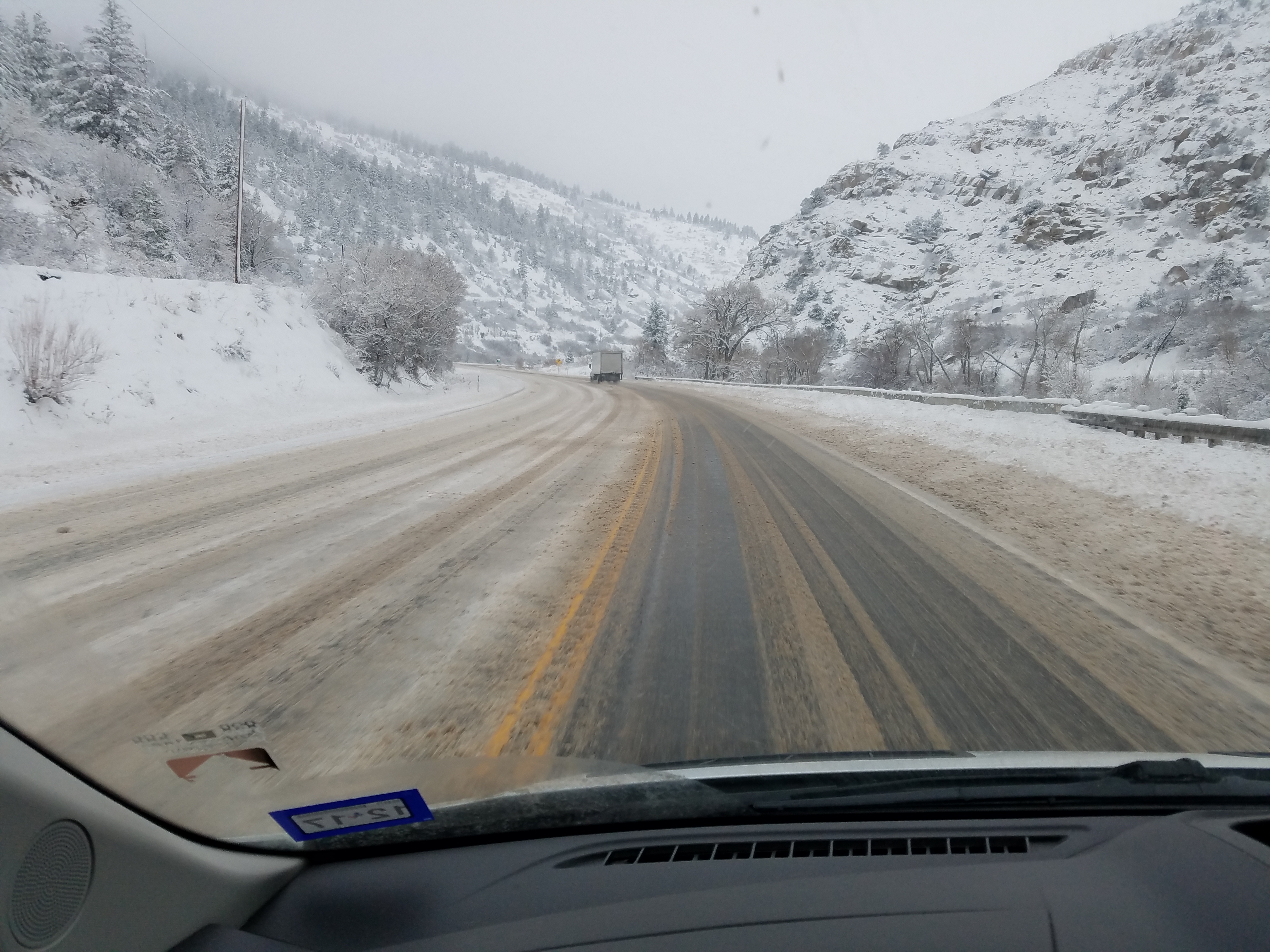
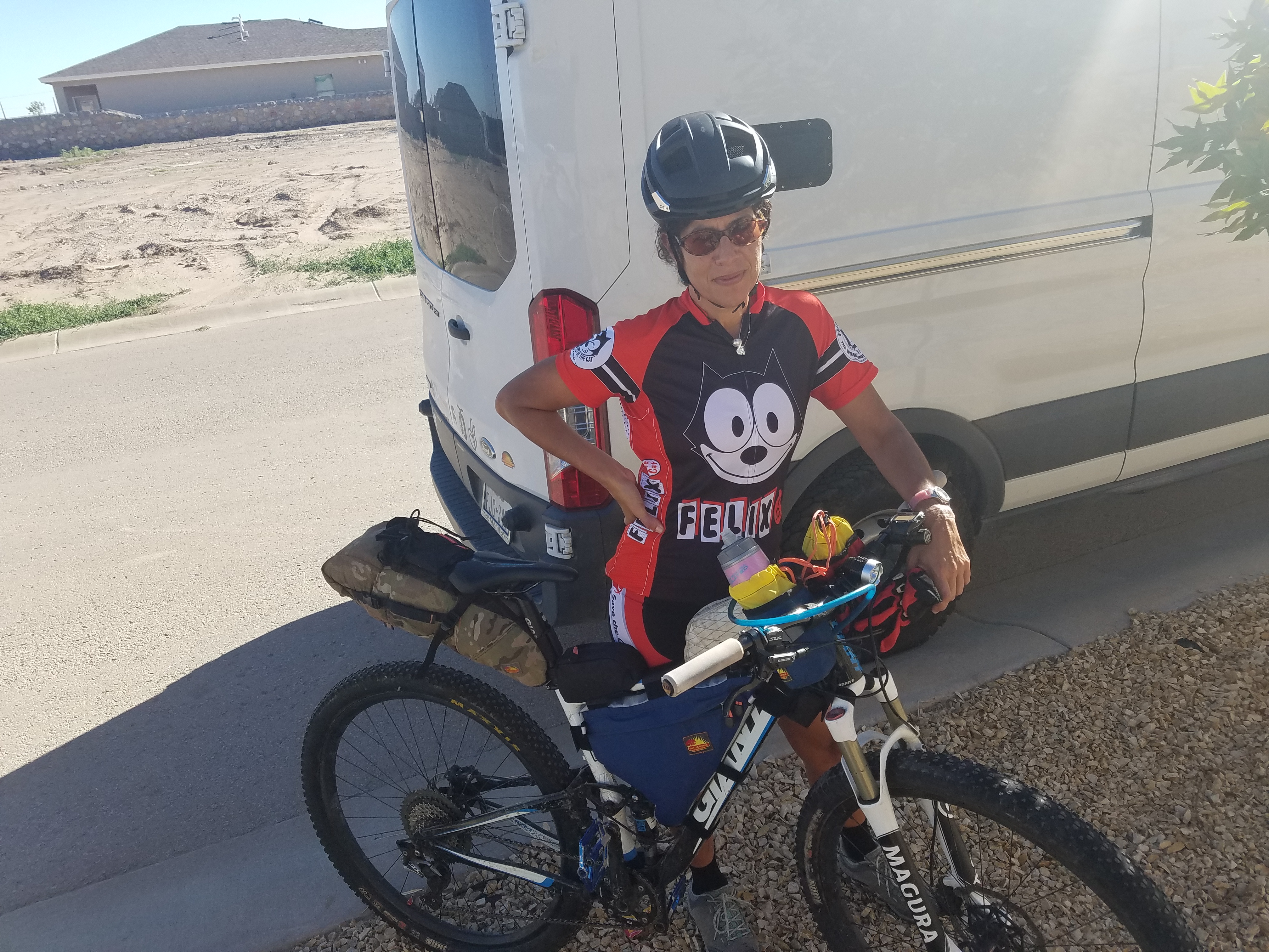
The route took us north of Riley Peak, west of it, then south…where I took the only photo of the ride.
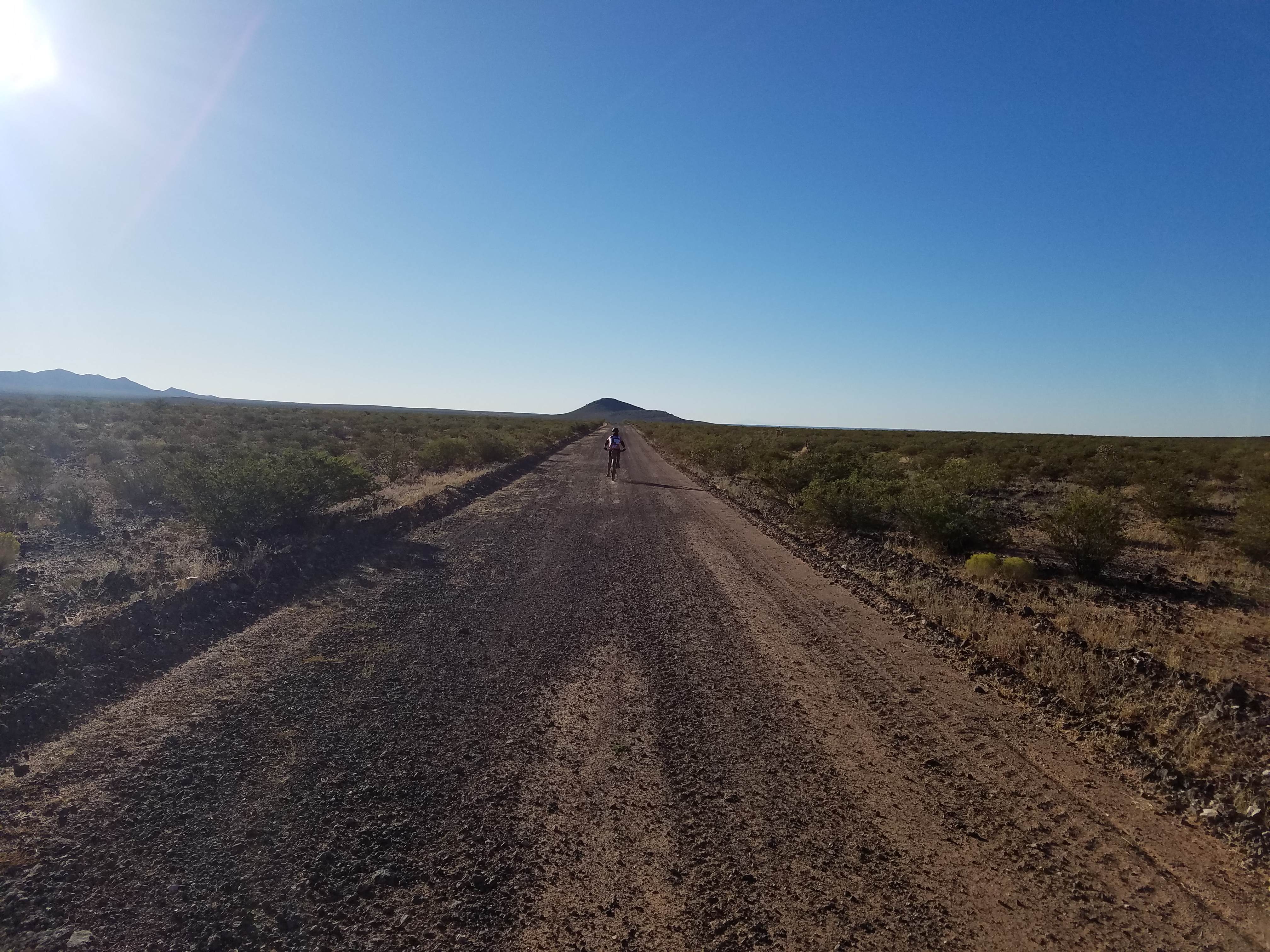
The freshly graded road was pretty fast heading south, then we headed west again and it was more of a trail. I saw a hose leading up to a tank and found the tank. It was not the source of the hose, but the tank being filled by the well……a mile or so back. Luckily there was a pretty clean, accessible tank being fed by this system. I tried pumping again but it was difficult and slow. I filled a quart saucepan with water and had to fill my stove twice to bring the water to a full rolling boil. After a slow boil of around 5 minutes, I decided to pour some into a Mountain House meal, let the rest hit a rolling boil, then dumped the rest in my bottle and bladder.
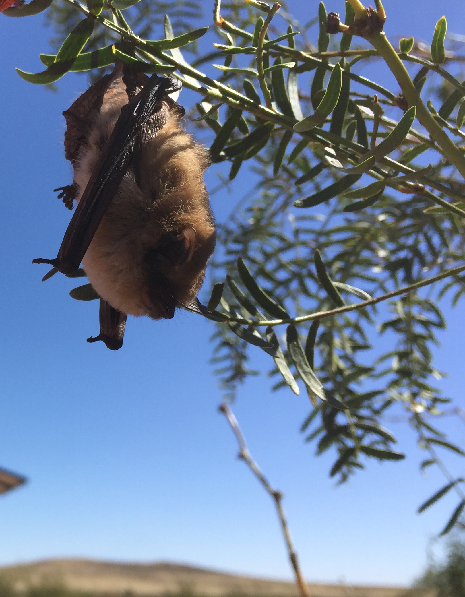
The route ended up in a wash for quite awhile and I guess we were on and off what was supposed to be a jeep road until we hit a fence line…..the most southwestern portion of the Monumental Loop. After looking at my gps and checking my phone which was down to about 27% battery, we decided to head more northeast and try to hook up with the course again. We passed another solar well with wires that had been disconnected. I attempted to make contact with the bare wires from the pump to the plug hanging off the panels, but couldn’t get them in. While milling around some shade, I saw a bat go into a mesquite tree. This is the only picture Selena took.
A few hundred yards away was another muddy tank and we attempted to filter and I gave up at just over half a bladder. We continued on and came upon a guy tending cattle. Not really needing water at the time, we continued on until we came upon a beautiful tank being filled by a working solar well. It was pumping gloriously clear water. At this point I looked at my phone and saw that we were closer to the popsicle stick of our ride as opposed the the route that would take us to Mesilla. Not wanting to risk running dry, not knowing how sandy the route might be, and not seeing a way to link up to the main course without killing my phone, we decided to link up with our entrance route and ride the section we skipped in order to get to Ray’s place. It was pretty sandy so we aired down our tires. We passed Kilbourne Hole and another large tank full of water, and then we were back tracking our tracks from the upper valley of El Paso to finish our 111 mile adventure just before sunset. While we were on dirt, we saw 3 vehicles plus the party of ATVers/Jeepers.
Lessons Learned
- Always check your gps file and make sure the entire thing shows up on your device.
- Always carry backup water treatment options. Tablets of some sort would have been fine for this entire trip as we found several sediment free sources that would have been fine after treating with tablets.
- Research the route better. I definitely did not research this route enough and ended up only riding about half of the section we wanted to ride. We were bummed not to finish in Mesilla as we were hoping for some deliciousness from one of the many restaurants in town.
- Wait to ride this route when the daytime highs are no more than about 85 degrees. It was forecasted at 89 in El Paso/Las Cruces on Friday and I never checked it after. Nor did I check the lows. Assume it will be about 5 degrees hotter around the craters and on the lava strewn sections of the route and assume it will be 10 degrees cooler at night than what is forecasted in El Paso/Las Cruces. We got lucky with winds and stronger winds prevailed on Sunday when we were heading back….tailwinds! If it had been a headwind, we would have finished well after dark.
- Bike choice. You’ve got some options that should all have their pros and cons. Fat bikes will be awesome on the sandy roads especially if it’s been a few weeks since rain. No bigger than a 4.0 though. There are a few rocky sections with rocks that could cut sidewalls, but mostly it was just rounded but rough lava rock. This section of the route is plus bike heaven. Keep in mind that Selena did great with wider 29er rims and the fast rolling Ikon 2.35. Her total setup was a very respectable 46 pounds and she is a fly-weight. I know plenty of really fast guys who start races with about that weight. My rig was way too heavy for my personal tastes, but I got a great weekend of “resistance” training and at a comfortable pace, Selena was comfortable and not killing herself.
Next Time
I would like to at least complete this section of the Monumental Loop before the end of the year. If I do, I’m going to consider using Fargazmo …my custom Walt Works Fargo copy. I’ll run it with 2.5 or maybe even a 3.0 tire up front and the 2.35 Ikon…or if I can get it to fit….a 2.5 Schwable or Maxxis 2.5 tire….on my 30mm inside width carbon race wheels with my dyno hub. I’ll rig my light to the dyno, make sure I’ve got the correct gps file, start my ride early in the am in Vinton, and crank it all out.
If you were to do the perfect build for this section, I’d say a Salsa Deadwood or a Mone Bikes El Continente would be choice. This is drop bar country….lots of fast roads and you could easily find yourself in a decently evil headwind. I’d pass on the filter and carry at least 2 bottles in addition to a 100oz bladder, relying on the big tanks and wells for water that only needs a tablet to treat. As for the rest of the loop, I know most of the area south of the Organ Mountains, the Sierra Vista Trail into the Franklin Mountain State Park, is true mountain bike terrain except for the long stretch of deep sand that is present before you cross over the range before Hwy 404. That stretch in itself justifies plus sized tires and maybe a real fat bike if it hasn’t rained in more than a week. As for the area north of Cruces….I know nothing about it and need to do more research.
Matt Mason is planning to do a mass start event on this route on Halloween weekend. I may have to get my shit together and give it or another section of it a go.

 I sat here for several minutes listening to the song of a canyon wren. Catherpes mexicanus. It’s a tiny little bird with a loud and distinctive song. Their songs differ in different locations…..like a southern accent….which can be different in South Carolina compared to what you would hear in east Tennessee which would be different compared to what you would hear in Houston, TX. Linguistics. There are ornithologists that study these differences in song amongst the sa